Ocracoke Inlet
The last ferry from Hatteras leaves at midnight. It’s then a forty minute ride through a deep and disturbing darkness to the northern tip of Ocracoke Island.
These are some of the most treacherous waters on the Atlantic Coast. In recent years, the Coast Guard has averaged 10 rescue missions a month in Oregon Inlet just north of here. Charts for the region don’t show channel markers; instead are displayed just warnings such as this:
“Hatteras Inlet is subject to continual change.
Entrance buoys are not charted because they are frequently shifted in position.”
We leave the landing from the sheltered Sound side of Cape Hatteras, and hug the low, marshy shore – close enough to see grass waving on the duneline against a field of stars, and hear the pounding surf on the other side. The pilot, despite thousands of crossings, keeps a powerful spotlight on at all times, lancing it through the darkness in nervous twitches from one buoy to the next as though looking for reassurance, and sweeps the confused surface for new hazards drifting in on the tide since the last crossing.
The boat makes sharp turns for no apparent reason. It snakes back and forth superstitiously, following an invisible channel. As we clear the last spit of land the sound in the air changes, and the wide restless Atlantic opens up on the left like the floor of an enormous coliseum. It doesn’t help to know, at this point, that out there on the bottom lie the wrecks of hundreds of less fortunate vessels. It feels like we’re a mouse crossing the door to the room where the cat sleeps. There’s a palpable sense of relief once we’ve reached the other side, and again have some land between us and the ocean.
From the landing at the northern tip of Ocracoke it’s still a 12 mile drive down the empty sandblown road to the town. Except for the actual village of Ocracoke at the far end, all of the island is National Seashore, so we pass no other signs of civilization – just mile after mile of dunes and surf. In the headlights we only see stands of sea oats and myrtle quaking in the wind. It makes the drive seem especially long and dark.
The Village
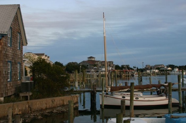
You can easily walk to anything within the village of Ocracoke. With a bicycle rented from the corner ice cream parlor, you can see the whole thing in an afternoon. Most of the town curls around the north side of the harbor, though some of the newer portions – notably a partially completed housing development – lies farther back toward the sound. Most, if not all, of the businesses are locally owned, either by natives or longtime residents. This gives it a distinctly small town feel, made all the more so when you realize the proprietors not only all know each other well, but most can delineate how they are related through distant family connections. These close ties, the remote location, and its designation as National Seashore, have protected Ocracoke from the more rapid development that long ago irrevocably changed the character of places to the north, like Nags Head and Kitty Hawk.
What this means is you won’t find any of the usual attractions and distractions that spring up like weeds around more typical tourist destinations. You won’t find crazy golf or skee ball on Ocracoke. Nor will you find fast food, sports bars or hotel franchises where you get the same familiar food, stay in the same room with the same carpet and framed print on the walls, as any other place in the country. Expect every dining and lodging experience to be different, reflecting the personal tastes of the owner. Expect to be surprised.
At the Crews Inn Bed & Breakfast, for instance, not only will you not find an internet connection (high speed or otherwise) but there is not a TV anywhere on the premises. While this may not be universally true, my guess is neither is it all that uncommon. Traveling with a teenager made this part a little dicey at first, but only briefly.
We did miss the internet access, but were able to find open high speed wireless connections around the harbor. Even so, it was nice to have to make an effort to use it, as it kept our attention on immediate surroundings and other guests at the Inn while we were there, instead of the latest YouTube clip. Once a day a walk up to the docks to check email turned out to be plenty. And neither of us ever missed the TV. Ever.

The Crews Inn is owned by Alton Ballance, a multi-generation native of Ocracoke. The house, now the inn, was the childhood home of his cousins, and he lives next door. He is a teacher and assistant principle at the only school on the island and has served on the state Board of Commissioners. He also wrote a book, Ocracokers, about the island’s history and residents, the proceeds of which he donates to the school. His brother is owner and innkeeper of other family properties, and also cares for the last member of the only African American family native to Ocracoke, now in her 90’s.
There are two tides affecting life on the island, both are seasonal and water borne: one is controlled by the moon, the other by the ferry schedule. Like schools of fish coming in to feed, the island is awash with people during the middle of the day. However, most visitors to Ocracoke are day-trippers; that is, the majority take a ferry over in the morning but are sure to catch another off island by evening. With three separate ferry routes servicing Ocracoke – making the island a sort of ferry crossroads – this is fairly easy to do. But as the shadows get long the crowds gradually disperse. The village is by no means deserted after 5, but the pace slackens profoundly by supper time, making strolls along the waterfront at sunset decidedly more peaceful than at noon.

Past is Present
Ocracoke, and its island residents, have a long and varied history. For several hundred years, since the 1500’s in fact, the inlet between Ocracoke and Portsmouth islands was the primary entrance to the Carolina Sounds, and from there to the mainland, making it an important location for shipping. It also lay in close proximity to the Gulf Stream and the main sea routes to Europe from points as far south as Central America. This vantage point also made it a good location for “privateering.”
Edward Teach, otherwise known as Blackbeard, used Ocracoke as his primary base of operations until he was captured and killed in 1718. The drifting sand bars and sudden storms gave cover from naval patrols and men-of-war unfamiliar with the local waters. For years he plundered with impunity under a pay-for-pardon arrangement with Governor Eden of North Carolina, ranging freely from the Outer Banks to the Bahamas. As a result, it fell to Governor Spotswood of Virginia to send a company of men and two shallow draft sloops to Ocracoke to rectify the problem. Teach was killed with great difficulty in an ambush, withstanding over 20 sabre slashes and 5 pistol shots before he collapsed from loss of blood. His head was carried back to Virginia mounted on a bowsprit, and displayed on a pike in Bath.
Long after pirating died out, so to speak, having intimate knowledge of the area could still be used to financial advantage. To this day, due to shifting shoals and channels, only local pilots can safely navigate through the inlet. As a result, the majority of early residents were pilots, and piloting remained a primary and profitable business of Ocracoke well into the 1800’s.
In 1846 a hurricane opened a new deeper inlet to the north – Oregon Inlet at Hatteras – which soon became the preferred route as Ocracoke Inlet began to shoal up and was soon too shallow for reliable passage. Piloting as a profession quickly dried up here. In it’s place, islanders made a harder living fishing, lifesaving and wrecking.
Shipwrecks have been washing up on the Outer Banks since the earliest explorations of the New World. Over 500 wrecks have been documented since 1585. When a ship ran aground on the beach, it’s contents were salvaged, auctioned, and hauled to high ground first by hand, then horse drawn cart, and eventually on specially converted trucks. The goods were then resold or reused. Many of the homes of Ocracoke still standing today were built with timbers and lumber taken from these wrecks.

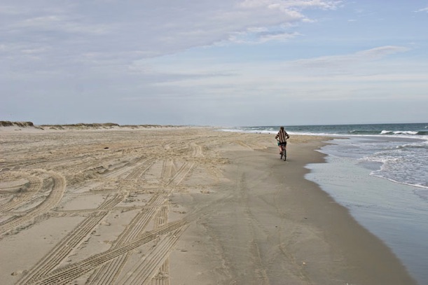
It took another 100 years for a new economy to come to the island. Even then the transition was slow. With the coming of regular ferry routes, and bridges providing easy access to islands up the coast, tourism has only in this generation become the island mainstay. Due somewhat restricted access, the beaches are relatively deserted and wild. With a 4-wheel drive vehicle, and a little courage, you can drive above the surfline from certain access points. Otherwise, there are parking areas with boardwalks elevated over the dunes, requiring a short hike. Essentially, there are no houses or hotels right on the beach, just 12 miles of sand and surf and wildlife. This makes it popular with fishermen and birdwatchers, interspersed with families and a few sun worshippers.


